This is the second video post in my Shackleton’s Fold One Place Study series.
A One Place Study brings together aspects of family history, local history and even house history. They are often carried out by family historians looking to learn more about their ancestors. A One Place Study might add new records, broaden out the focus or just bring a new perspective to our research.
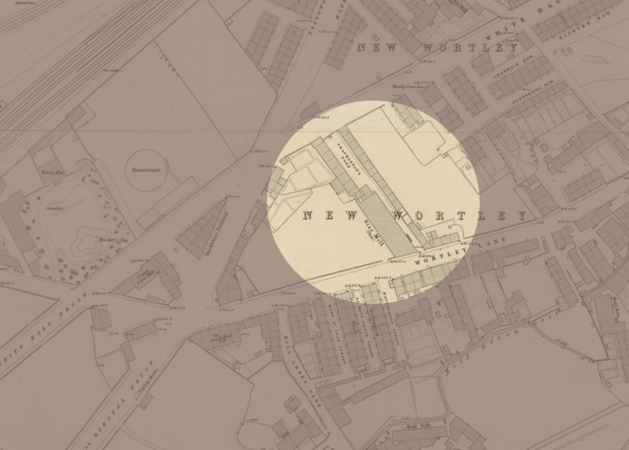
Shackleton’s Fold was a small ‘street’ of just nineteen houses that stood in the New Wortley area of Leeds for more than ninety years. It was demolished by the end of the 1930s. In the video linked below I use maps and old photos to try to explore the area where it once stood.
I found this process so useful in helping me to imagine what Shackleton’s Fold was like. Poring over old maps and finding photographs of buildings all around the Fold – alas none of Shackleton’s Fold itself – really helped me to focus.
I hope this video will be of interest to family historians, local historians and people doing or thinking of doing a One Place Study. In addition, people with a general interest in Leeds history, specifically the history of New Wortley may find it interesting.
I’m particularly keen to attract other family historians whose research has taken them back to Shackleton’s Fold between the mid 1840s and 1938. Alongside this visual exploration, I’m in the process of creating a database of every person on the censuses and every voter listed on the electoral registers. I’m looking for stories and photographs and would be very grateful if anyone could help out in that regard. I’ve already found some interesting stories.
If you fall into any of these categories, or know someone who does, please do share a link to this post and/or the YouTube link – and please ‘Like’ the video if you have a YouTube account. I hope you’ll find it useful.
Information and Links for photos and maps used
All photographs from Leodis: https://Leodis.net
Go to Advanced search and key in the ID given.
- JR Holmes and Star Maltings on Wortley Road, 1965. ID: 2003729_72382754
- Star Maltings and Shackleton’s Fold on Wortley Road, 1965. ID: 2003729_99482364
- View from St John’s Street to side view of Star Maltings and former Shackleton’s Fold, 1965. ID: 2003729_88186282
- 107-109 Whitehall Road, with view of St John’s Street, 1965. ID: 2003729_31147402
- Whitehall Road School and Kildare Terrace, 1948. ID: 5624
- Whitehall Road School, 1948. ID: 2818
- Whitehall Road at the junction with Gelderd Road, Trolley and Tram Junction, undated but possibly 1911. ID: 2011127_173010
- St John’s Sunday School (bombed 24th/25th August 1940). ID: 200828_166072
- St John’s Street, from L to R: 11 to 15, 1965. ID: 2003729_52465457
Tithe apportionment of Wortley (township in the parish of Leeds)
1846. The National Archives, Kew. Reference: IR 29/43/444
Ordnance Survey Maps located at National Library of Scotland Maps: https://maps.nls.uk
Reproduced with the permission of the National Library of Scotland
OS: Leeds Sheet 13: Surveyed: 1847, Published: 1850. (Railway revision to c. 1862)
https://maps.nls.uk/view/229947003
OS: Leeds Sheet 17: Surveyed: 1847, Published: 1850. (Railway revision to c. 1854)
https://maps.nls.uk/view/229947015
OS 25-inch England and Wales: Leeds – Yorkshire CCXVIII.5.13: Surveyed: 1888, Revised: 1910, Published: 1911
https://maps.nls.uk/view/229947306
OS 25-inch England and Wales: Yorkshire CCXVIII.5: Revised: 1906, Published: 1908
https://maps.nls.uk/view/125642449
O.S: Yorkshire CCXVIII.5: Revised: 1932 to 1933, Published: 1934
https://maps.nls.uk/view/125642455